What to see and do
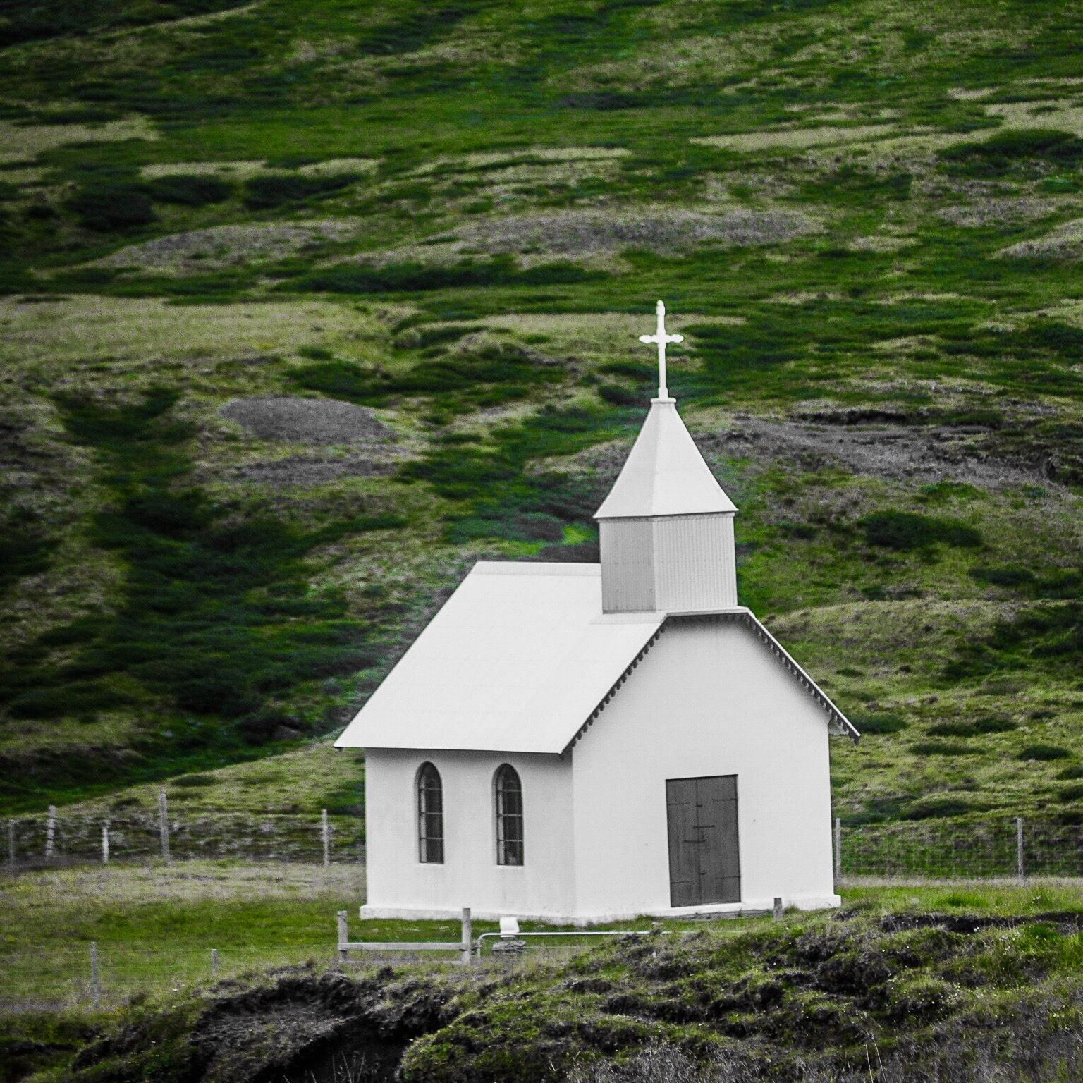
Eiríksstaðakirkja
The church at Eiriksstadir is the oldest concrete church in the east side of Iceland. The church used to be located at Bru, a farm not far from Eiriksstadir. In 1913 this church was moved from Bru to Eriksstadir. The altarpiece in the church was made by the painter Jóhann Briem, but the altar and the pulpit of the church used to be in the church at Bru. The old altarpiece located in the church once the church was at Bru was painted in 1794 by Jón Hallgrímsson and is now preserved at the National Museum of Iceland. This old church at Eriksstadir was built between 1911 and 1914 and during the construction period, only 80 packages of concrete was used to build the church.
Dam Kárahnjúkar
Karahnjukavirkjun is a Hydropower plant in Eastern Iceland, designed to 4600 GWh annually to serve Alcoa’s aluminium smelter east of Reydarfjordur in Northeast Iceland.
The Karahnjukar plant takes its energy from the dam at Jokulsa a Dal/Bru glacier river and Jokulsa in Fljotsdalur with five dams altogether and three reservoirs. The largest dam is also the largest of its kind in Europe, 193 m high and 730 m long and comprised of 8.5 million cubic meters of material. It’s a fantastic experience to walk along the rim of the dam and look down into the spectacular canyon below. It is impressive sight and gives you a sense of how tiny the human really is in comparison with nature when you stand in front of this magnitude and scale.
Waterfall Rjúkandi
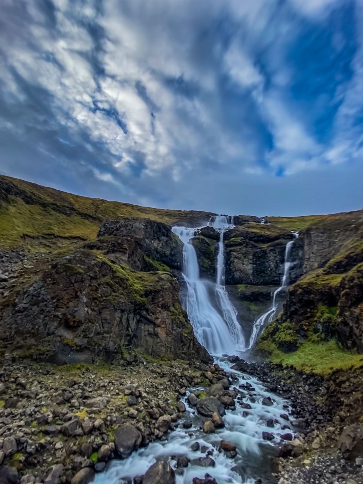
Rjúkandi is one of the few major waterfalls on the north side of Iceland which can be seen directly from the Ring Road. The falls descend the steep valley of Jökuldalur carved by the Jökulsá a Brú river.
The stream which the falls occur along, the Ysta-Rjúkandi, is one of three streams bearing the name of Rjúkandi in the immediate area.
To the southwest of the falls one can see the Fremsta-Rjúkandi forming its own waterfall as it stairsteps down the valley, though in a considerably less impressive fashion. In between the two streams is the Mið-Rjúkandi, which has a considerably smaller drainage basin and was only a wet stain on the cliffs when we passed. In addition, a multitude of other waterfalls can be seen in Jökuldalur between this location and the village of Egilsstaðir.
Old farm at Sænautasel
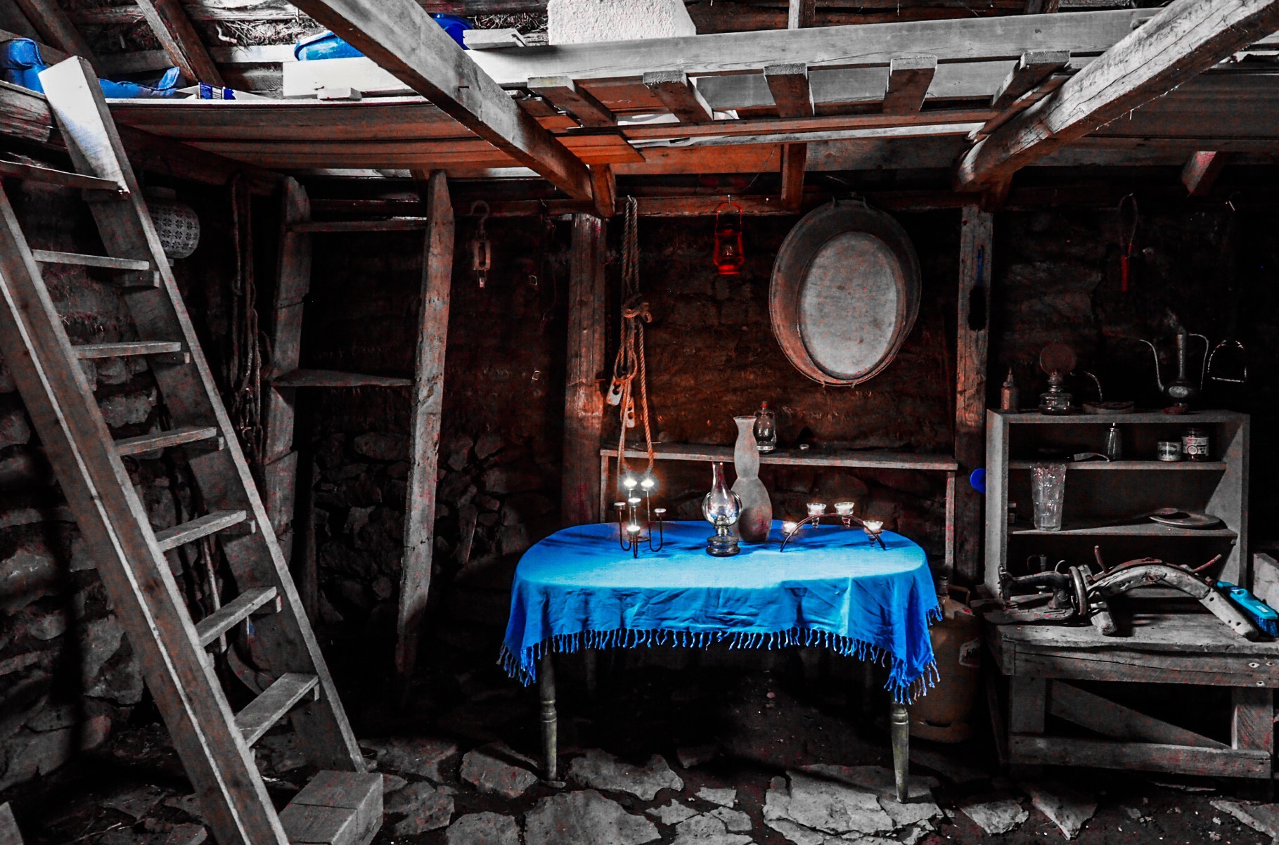
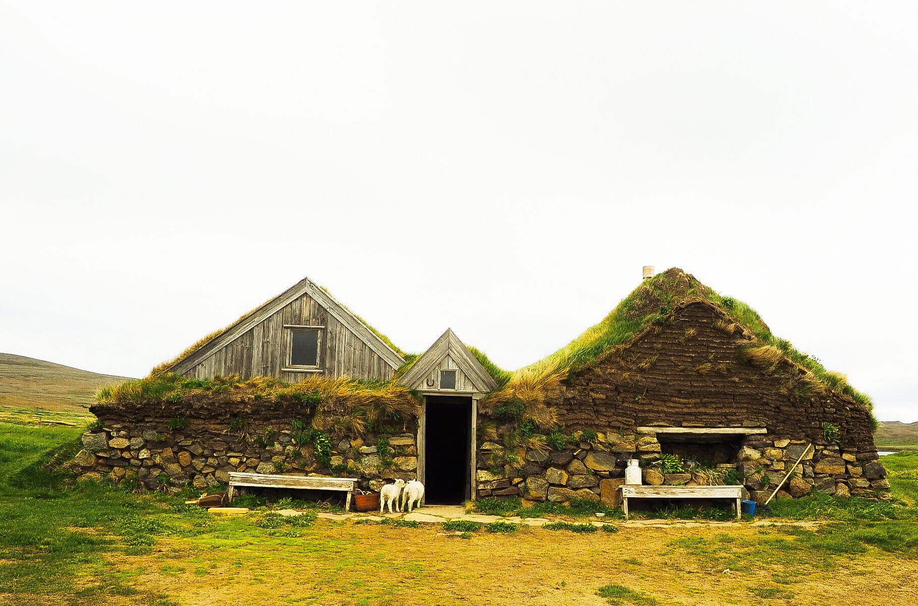
For 95 years people lived in this beautiful turf house – (from 1843 to 1943) when the last people moved out. From 1840 until 1862 sixteen turf houses were built on the heath. Now only the rebuilt Sænautasel is remaining.
Snænautasel is one of the homes, which had to be vacated when Askja caldera erupted back in 1875. It was not until 5 years later that people moved back into Sænautasel turf house. Since then it has been rebuilt a couple of times.
In 1992 Sænautasel was rebuilt from scratch and is now a museum.
Binnubúð at Hjnúksvatn
Hnjúksvatn is one of the 30 Pearls of Egilsstaðir region and refers to some of the most stunning hikes of the area.
It is a lake on the heath across from Merki farm. The plateau on which the lake is located, is characterized by rounded cliffs and moors. To reach the lake, you should follow a trail along the Hnjúksá river. There you will find a hut, Binnubúð. Brynhildur Stefánsdóttir, a midwife from a farm in the area, had it built in 1983 for those who wished to visit and enjoy the highlands. Brynhildur loved the heath and the outdoors. She used to catch in this lake when she was young. She went across the river with a cable car with her nets and then carried the fish home the same way. After she became a midwife, she travelled the heath back and forth to deliver babies, in summer on foot, in winter on skis. Brynhildur passed only a few months after the hut was built so she unfortunately never had the chance to use it herself.
Old turf sheep house at Hjardarhagi
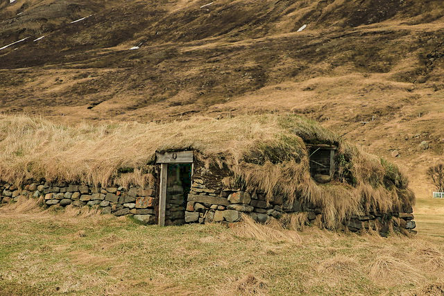
The turf houses of Hjarðarhagi farm. For centuries the outhouses of Hjarðarhagi were in a cluster of six buildings, most of them still in use until the 1970’s. Today, the two old sheephouses are the only ones still standing, the others were demolished in the 1970’s to make space for Road No 1.
The houses came under the supervision of the National Building Heritage Board of Iceland and are now supervised by the Cultural Heritage Agency of Iceland.
The style and materials of the buildings are traditional, turf, stone and wood, and roofs lined with brushwood under a cover of turf.
You are welcome to look around and take pictures but walk with care.
These turf houses are typical for the single feeding-line sheep house. They were only slightly modified during their time of use and all basic dimensions are original. The houses have now been restored to a completely original state, as all latter-day modifications have been removed.
In later years Efstahús was used as a lambhús (house for sheep in their first year), almost unchanged from its original form.
Askja
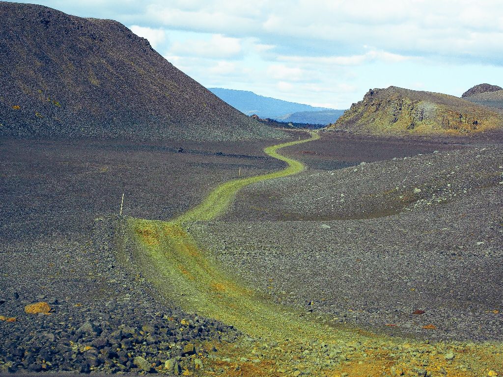
Jokuldalur is the gateway to the highlands from the north-east. Accessible from June to September.
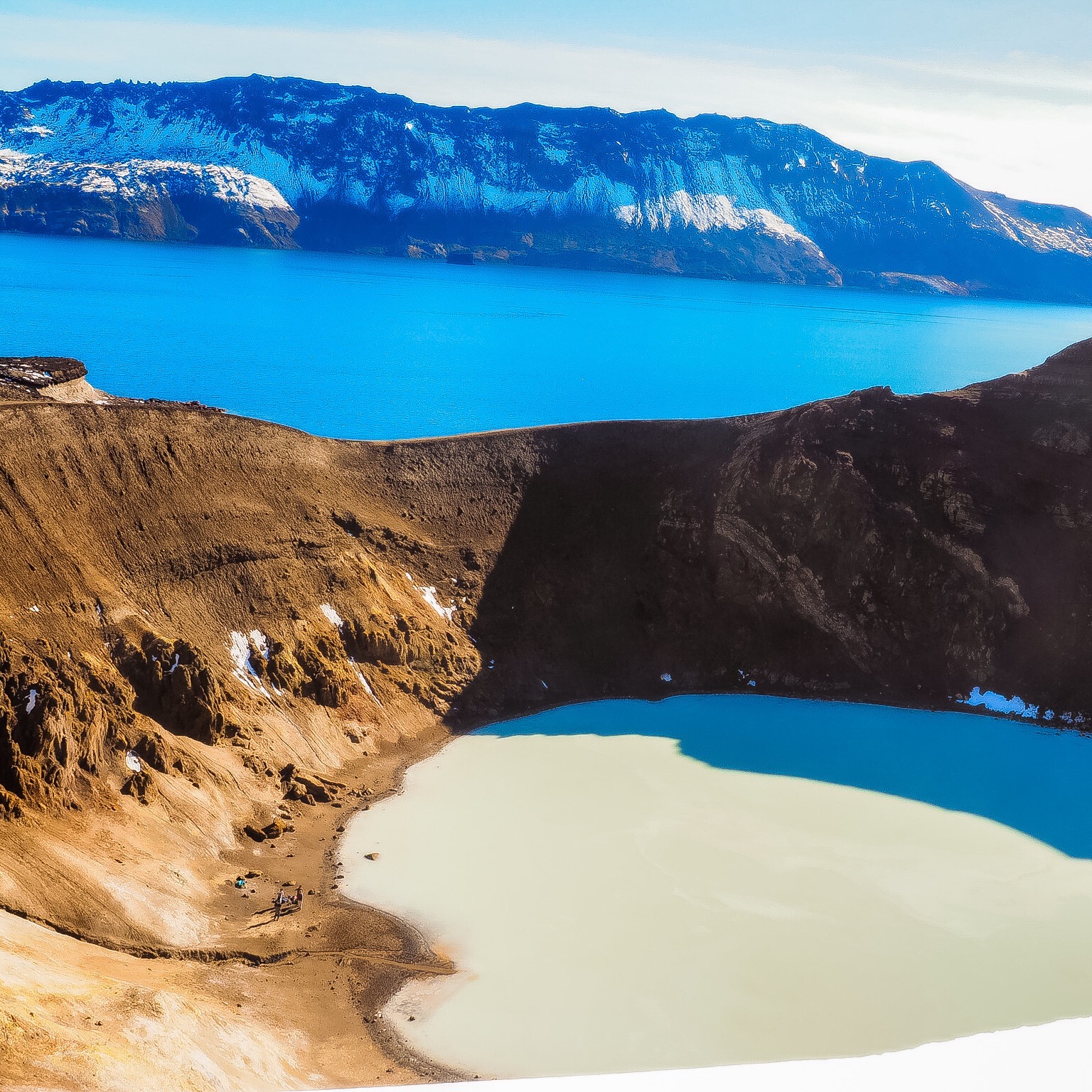
Askja Caldera (50 km2) in the Dyngjufjoll Mountains, on the northern side of the Vatnajökull National Park. The mountains emerged in eruptions under an Ice Age glacier cap. Askja itself was formed, for the most part, at the end of the Ice Age in a major ash eruption which caused the roof of the magma chamber at the heart of the central volcano to subside.
The caldera contains several volcanoes, including Víti (explosive volcanic crater). Water has accumulated in the crater, its temperature is variable – it is around 30°C on average. Víti is a popular bathing site, but if you intend taking a dip, please be aware that the sloping path is very slippery in wet weather.
Be mindful that you need a 4×4 vehicle to access Askja as there are some unabridged rivers to cross. This part of the country is only accessible for a few months of the year, mostly from June to September, depending on the weather and road conditions.
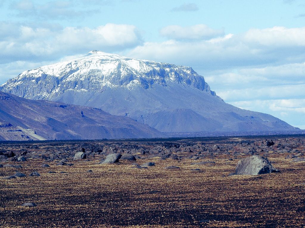
Herdubreid
Herdubreid is a table mountain, situated north of Vatnajokull in the deserted lava field of Odadahraun, the most extensive lava field in Iceland.
This impressive mountain, 1682 m high, is often called ‘the queen of Icelandic mountains’ and was voted the Icelandic ‘national mountain’ in a 2002 poll.
Vatnajökull Natural Park
Vatnajökull National Park was established in 2008. It includes the national parks in Skaftafell (est. 1967) and Jökulsárgljúfur (est. 1973) along with the Vatnajökull ice cap itself and extensive areas around it.
Vatnajökull National Park is characterised by diversity on all fronts, be it landscape, biosphere, cultural remains or service levels. For simplification, however, it may be placed into two categories: uninhabited highland areas with limited services and lowland areas with higher service levels.
The park‘s visitor centres are all located in lowland areas. Each of them has an exhibition about the park‘s nature and cultural heritage. Each also has a souvenir shop with special emphasis on local handicraft and products.
These are among the many things to do in Iceland.
